Region: AB, Canmore Area / Bow Valley
GPS Elevations: Gap Peak 2484m (8150ft), Mount Fable 2712m (8898ft)
Difficulty: 4th class (should be 3rd if done correctly)
Style: Solo
Total Ascent: 1859m
Distance: 20km
Duration: ~10h30min
TLDR
- Highlights: Lots a nice rock geology along the traverse and ending with Fable means ending with the highest quality limestone rock.
- Key Takeaways: Ignore any painted arrows on the 2nd cliff band and go left (West) as advised in Kane’s book. Expect a slow progress on the way out Exshaw valley as you maneuver countless crossings and good luck keeping your feet dry.
I had a week long trip planned in the Purcell Mountains at the end of July but wanted to get my legs in shape prior to that so I planned a week around Canmore. Taxing the legs with elevation gain can be difficult when living around Montreal and the most I managed to pull off (before it got too hot and humid) was 6 laps up Mont Royal which still only provided around 800m. So my goal was to do 3 outings over a course of a week and this one was my first choice after browsing various options in Kane’s book. The route looked like it would provide good distance without going too crazy on the elevation gain for day 1; Kane’s book noted “1425+ m”. Then I’d rest a few days before bagging some more peaks. Well, at least according to my GPS (as noted in the stats above) the total gains ended up being noticeable more than 1425m and by the end of the day my legs were in distinct agreement (or rather disagreement) with this.
I decided to park at the Grotto Canyon Trail Head because I preferred leaving the car all day at a more formal and visible location. However, I didn’t know if there was any formal trail from here leading to Gap so I when I hit the drainage from the main trail and just headed up it a short ways and then when it became too difficult to follow easily I just cut left into the trees and started bush whacking. Thanks to rain the prior day things were pretty wet in the trees, but the forecast was for sun so I figured I’d dry off quickly enough above the tree line. There was quite a lot of flagging as I hiked adjacent to the drainage but eventually I came upon a pretty well defined trail so I get the feeling the flagging was outdated and that there was likely a much better point to start from, probably more towards the plant where Kane’s book recommends parking.


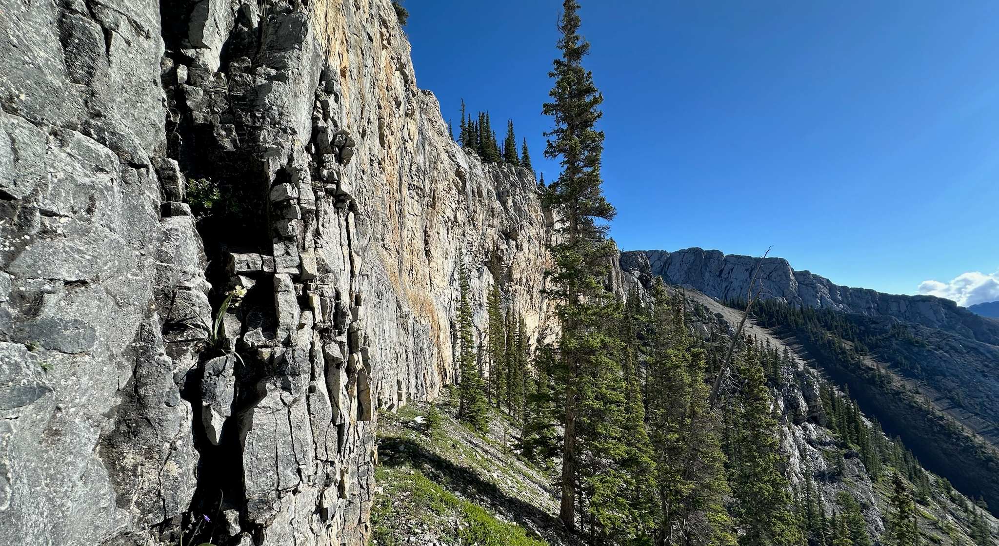
Within the first hour I was starting to break out of the trees and half an hour after that I was at the first cliff band. Kane’s guide clearly states the first cliff band should be passed on the right (East) side and the second one should be passed on the left (West) side, but for some reason the big painted arrows found on both walls made me forget about this (both of which point right). Well that and the fact that you can see gentle scree slopes leading to the ridge beyond the second cliff band. In any case, this turned out to be a mistake and led to unintended, exposed, and somewhat wet 4th class climbing. That wouldn’t normally phase me too much but the loose rock that followed it, somehow suspended against gravities will at the cliff top-out, certainly turned me off.


Left: First cliff band. Nice potential for some sport climbs here. Right: Second cliff band which I’m incorrectly passing on the right. Also good potential for sport climbs but would be a rough approach w/o a proper trail from the 1st cliff band.
Once around and over the two cliff bands gaining the ridge and following it to Gap is straight forward. And then Gap presents a nice view of where the fun begins as well as Fable. There was even a summit register on Gap which I wasn’t expecting, but it confirmed that my day was likely to be a quite one as nobody had been up here since June.


The scramble towards gap was quite enjoyable for both all the different kinds of rock geology you encounter and the lack of a well defined path which adds a nice hint of adventure and problem solving to the day. Do I go left or do I go right? Should I remain low or climb to the crest? And so forth. The initial departure from Gap is the most exposed section of the ridge. I actually by-passed most if it via a steep gulley that descends west of the summit, but in hind sight remaining on the crest would’ve been much more elegant. Then the rest of the traverse is mostly route finding with some steps and many different scrambling options. I opted for the steeper scrambling/traversing options as it provided better quality rock.


Descending to the col I found a little ugly, at least it was in mid July. Most of the scree had already been scraped off the upper slopes so you couldn’t heel plunge and what was left didn’t provide much traction. But an uncomfortable mix of butt scooting and insecure side stepping got me down. Looking back I think descending nearer the crest of the col’s shoulder could have been better (I chose a path a little South of the col and then angled towards it).
By this point in the day clouds were looking more threatening so I picked up the pace and scrambled up Fable from the col about as quickly as I could. The summit rockpile had a cross in memory of somebody who perished from a fall on Fable but I didn’t find any sort of summit registry. Also, from this point it’s not at all obvious is this is the true summit or not as there are similar high points further SE along the summit ridge and I spotted at least a couple other cairns/rockpiles. I assumed these other rocks were placed by climbers but I decided to traverse to the next one in view because it seemed slights higher than where I stood. However, once there, there was no obvious gain in elevation and the previous rockpile (with cross) now looked to be the one that was slightly higher! I deemed that not worth the effort (traversing there was considerably more exposed than the scramble up), ditched any thought of traversing further to the next rockpile, and headed back to descend while the weather was still dry.


Left: The summit rockpile on Fable with a memorial cross. Right: A little further (SE) down the summit ridge line (not recommended) with the cross in view in the background. There was no noticeable change in elevation at this point.
On the way down scree slopes after the col I met the only other company I crossed the entire day: a mother mountain goat and it’s kid goat (whatever that is called… actually I looked it up and it turns out the formal name for a young goat is in fact “kid”, how about that). While the mother observed me with a watchful eye, the kid sort of just stared curiously at me wondering, I suppose, what this obnoxiously loud and ungraceful creature was stomping down the hillside.

Soon after getting off the scree slopes it started raining and I was glad to not have hung out on Fable any longer than needed. In any case, the rain didn’t persist and the sun was back out before too long.
The rest of hike was pretty uneventful, and becomes a little tedious actually due to all the river crossings required to get down the Exshaw drainage. I managed to get through them all with minimal boot soaking, but any other time of the year when the water would be higher I’d expect the boots to have to come off several times. Many crossing points have logs across them already, but many do not. I was happy to have two hiking poles with all these crossings to both aid with balance and for pole vaulting.


Left: Neat texture on this boulder I crossed in the drainage. It was like natural stucco. Top-Right: Rain clouds which were threating all afternoon finally making a little fuss. Bottom-Right: Sin back out in no time.